
| Camp Clipper and Camp Essex | |
| Coordinates: | 34.7985°N -115.2677°W |
| Area: | 21,537.78 acres |
| Built: | 1942 |
| Architect: | US Army |
| Designation1: | California |
| Designation1 Number: | 985.5 |
Camp Clipper and Camp Essex were subcamps of the US Army's Desert Training Center in San Bernardino County, California, located near Historic Route 66 and the Santa Fe Railway. The main headquarters for the Desert Training Center was Camp Young. This is where General George S. Patton's 3rd Armored Division was stationed. Camp Clipper was designated a California Historic Landmark (No.985.5). The site of Camp Essex is located near the Fenner Rest Area in Fenner, California, on Interstate 40 and Route 66, 32miles west of Needles in San Bernardino County, California, near the town of Essex. Currently at the south end of the Mojave National Preserve. Camp Clipper was just to the west of Camp Essex. Camp Essex was a temporary camp for incoming and outgoing troops. Camp Essex was named after a small town near the camp, Essex. Camp Clipper was named for its proximity to the Clipper Mountains. Between Camp Essex and Route 66 was the 4,500 foot Camp Essex Army Airfield.[1] [2]
See main article: Desert Training Center. Built in 1942, Camp Clipper and Camp Essex were built to prepare troops to do battle in North Africa to fight the Nazis during World War II. At Camp Clipper were trained the 93rd Infantry Division. The trained troops went on to fight in the North African campaign. Camp Essex was a temporary (transitional) camp built for the handling of incoming/departing troops. When completed, Camp Clipper had 36 shower buildings, an outdoor theater, 191 latrines, 149 wooden tent frames, and a 50,000-gallon water tank. Also built was a 500,000 gallon concrete reservoir and two 740-foot-deep wells. Camp Clipper had 14 training ranges. The camp was used shortly in 1944 for Italian prisoners of war. The camp closed on 16 March 1944 and is now overseen by the Bureau of Land Management. The army used live-fire exercises and warning signs are still on the site.[3] [4] [5]
Operating Camp Clipper:
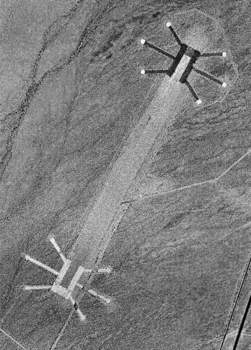
There was an air strip near Camp Essex to support training activities. The runway was two 4,500 feet long runs made of steel landing mats with 6 parking pads at each end of the runway. The runway ran north-south, parallel to the old U.S. Route 66. The runway was long enough for large planes to use in training exercises: (Per "Travel Information Desert Training Center" 8/4/43, these are the "Types of planes necessitating runways of 4000 ft (S.L.) minimum) A-20, A-24, A-35, 0-52, P-39, P-45, UC-78, RDB-7B, C-45, C-47, BT-15, O-61 AND BC-1). In early 1950 the airfield was used as a private airfield, being not maintained it was abandoned in the late 1950s.[8]
Marker at the Eastbound Rest Stop in California reads:[9]